
30 Best Map Illustration Ideas You Should Check

Source: Stuart Hill Illustration, Buffalo Map, Behance, https://www.behance.net/gallery/13106419/Buffalo-Map
A folded paper map on a café table, a fantasy kingdom sketched on old parchment, or a colorful city guide filled with tiny landmarks—every great map illustration has its own charm. It does not simply show where things are; it creates mood, invites curiosity, and makes people want to look closer. That is why map illustration remains one of the most exciting styles in visual design.
Some artists love drawing playful street maps with cute icons for coffee shops, parks, and bookstores. Others prefer dramatic treasure maps with aged textures, hidden paths, and mysterious symbols. Travel brands often use bright and modern map illustration styles to make destinations feel lively and unforgettable. Even wedding invitations and event guides become more personal when designed with a custom illustrated map.
The beauty of map illustration is how it blends function with imagination. It can guide, decorate, and tell a story all at once. In this collection, you will discover some of the best map illustration ideas that bring places to life, whether real or imagined, and inspire fresh creative directions for your next design project.
Map Illustration Ideas

Source: Manuna Grabarnick, Illustrated Map of Cyprus, Behance, https://www.behance.net/gallery/189845889/Illustrated-map-of-Cyprus

Source: Francesca Baerald, Behance, https://www.behance.net/gallery/19604983/Maps-for-Games-and-Private-Commissions

Source: Mike Hall, Maps for The Wheels of Chance, Behance, https://www.behance.net/gallery/173063659/Maps-for-The-Wheels-of-Chance-by-H-G-Wells

Source: Henrique Neves, Curitiba, Behance, https://www.behance.net/gallery/92266561/Inky-Map-Curitiba

Source: Tatiana Keiko, Карта фьорда, Behance, https://www.behance.net/gallery/193776057/karta-forda

Source: Jesse Bowser, Field Trip Camp Map, Dribbble, https://dribbble.com/shots/24578954-Field-Trip-Camp-Map

Source: Alex Krugli, Dribbble, https://dribbble.com/shots/23677594-USA-Travel-map

Source: Sasha Kolesnik, Dribbble, https://dribbble.com/shots/25836456-Map-of-my-Illustration-Interests

Source: Elly Walton, Dribbble, https://dribbble.com/shots/2258246-Rome-Map

Source: Tim Probert, Maps of Irpa, Behance, https://www.behance.net/gallery/128804711/Maps-of-Irpa

Source: Nikola Ovsek, Dribbble, https://dribbble.com/shots/23875206-Greensboro-Historic-Downtown

Source: Mads Berg, Tivoli Maps, Behance, https://www.behance.net/gallery/94860941/Tivoli-Maps

Source: Galina Pîlina, Dribbble, https://dribbble.com/shots/26024635-Zagreb-Illustrated-Map-for-Merch-Prints

Source: Nikola Ovsek, Dribbble, https://dribbble.com/shots/23788666-Capri-Map

Source: Kentucky Distilleries, Dribbble, https://dribbble.com/shots/17257522-Kentucky-Distilleries-Bourbon-Map

Source: Miguel Ornia-Blanco, Behance, https://www.behance.net/gallery/78373981/Fun-Maps

Source: Jan Kallwejt, Dribbble, https://dribbble.com/shots/24341275-Germany-Map-Illustration

Source: Stuart Hill Illustration, Sardinia, Behance, https://www.behance.net/gallery/95140417/National-Geographic-Map-Sardinia

Source: Hellsjells, Dribbble, https://dribbble.com/shots/5347706-Rema1000-Isometric-Map-Illustration-Closeup

Source: Olga Zakharova, Dribbble, https://dribbble.com/shots/6535423-Arizona-Map

Source: Lavilletlesnuages, French Maps, Behance, https://www.behance.net/gallery/124241825/French-maps-par-Lavilletlesnuages

Source: Gregory Baldwin, Behance, https://www.behance.net/gallery/68468611/ILLUSTRATED-CITY-MAPS-I-VOYEUR-MAGAZINE-35

Source: LeeAndra Cianci, Behance, https://www.behance.net/gallery/62321953/City-Maps

Source: Juan Carlos Paz, Behance, https://www.behance.net/gallery/4403723/MAPS

Source: Lena Schaffer, Behance, https://www.behance.net/gallery/93132913/Map-Illustration

Source: Aleksandra Artymowska, American Map, Behance, https://www.behance.net/gallery/53272399/American-map-editorial-illustration

Source: Dav Yendler, Cards Against Humanity, Behance, https://www.behance.net/gallery/71730493/Cards-Against-Humanity

Source: Paola Ortega, Behance, https://www.behance.net/gallery/91045863/Maps

Source: Bratislav Milenkovic, Behance, https://www.behance.net/gallery/107191021/Maps-and-Landscapes

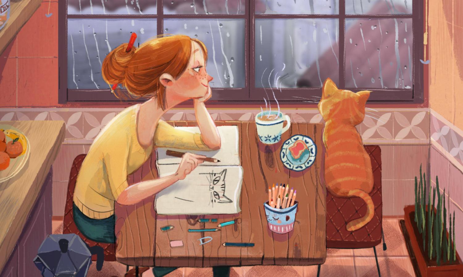
Source: Stuart Hill Illustration, Buffalo Map, Behance, https://www.behance.net/gallery/13106419/Buffalo-Map
What Are Vintage Treasure Map Illustration Ideas?
Vintage treasure map illustration ideas are full of mystery, adventure, and old-world charm. They instantly bring to mind pirate ships, hidden islands, secret caves, and long-forgotten treasures buried beneath the sand. A well-made map illustration in this style should feel like it was discovered inside an ancient wooden chest, complete with worn edges, faded ink, and hand-drawn details. The goal is to create something that feels both artistic and exciting.
Aged Paper And Burnt Edge Effects
The background sets the mood first. Use parchment-style textures with warm brown, beige, or sepia tones to create an old and weathered appearance. Slightly darkened corners, torn edges, and burnt paper effects make the map illustration feel authentic. These details help the design look like a real treasure map passed down for generations.
Hand-Drawn Compass And Decorative Borders
A vintage treasure design always looks stronger with a dramatic compass rose placed somewhere on the map. Add decorative borders with swirls, ink lines, or old cartography patterns to enhance the antique feeling. These elements give the map illustration more personality and help balance the composition beautifully.
Pirate Symbols And Hidden Clue Markers
Classic pirate-themed icons make the design more playful and memorable. Include skull symbols, pirate ships, anchors, palm trees, sea monsters, crossed swords, and of course the famous X marks the spot. Footprints, dotted walking paths, and clue arrows can make the map illustration feel like part of an exciting adventure story.
Fantasy Islands And Mysterious Landmarks
Instead of drawing a regular location, create a magical island filled with dramatic cliffs, volcanoes, caves, waterfalls, and secret tunnels. Add unusual landmarks like a giant shipwreck, ancient ruins, or a dragon’s cave. These imaginative features make the map illustration more visually rich and far more entertaining for viewers.
Old-Style Lettering And Ink Details
Typography matters in vintage treasure themes. Use hand-lettered labels, script fonts, or old serif styles to name locations like Skull Bay, Hidden Cove, or Golden Reef. Ink splashes, faded stamps, and sketchy directional notes add realism and charm. These small details complete the vintage look and make the map illustration feel like a true collectible piece.
What Are Cute City Street Map Illustration Ideas?
Cute city street map illustration ideas bring everyday places to life with charm, color, and personality. Instead of a plain location guide, this style turns streets, cafés, parks, bookstores, and little corners of the city into something playful and memorable. A good map illustration in this style feels warm, inviting, and full of tiny details that make viewers smile. It can be used for travel guides, local business branding, wedding welcome cards, neighborhood posters, or even personalized gifts.
Tiny Landmark Icons With Personality
One of the best ideas is using adorable mini icons for important locations. A coffee shop can have a smiling coffee cup, a bakery can feature a tiny croissant, and a bookstore can be shown with stacked books and little stars around it. These small details make the map illustration feel lively instead of ordinary. Landmarks become part of the visual storytelling rather than just labels on paper.
Soft Color Palettes For A Friendly Look
Cute city street styles work beautifully with pastel shades, warm neutrals, and soft watercolor tones. Light pink, sky blue, sage green, cream, and peach can make the entire map illustration feel gentle and welcoming. Bright colors can also work, but softer tones usually create that cozy hand-drawn atmosphere people love. Color choice shapes the mood immediately.
Playful Roads And Curved Street Layouts
Instead of strict geometric lines, use curved roads, winding paths, and slightly imperfect hand-drawn streets. This gives the map illustration a more personal and artistic feel. Sidewalks, bike paths, flower-lined streets, and tiny bridges can add even more visual charm. The design should feel like a storybook city rather than a technical city plan.
Neighborhood Life Details And Small Scenes
The cutest designs often include little daily-life moments. Draw people walking dogs, kids riding bicycles, couples sitting in a park, or street musicians performing near a fountain. These tiny scenes make the map illustration feel alive and emotional. It becomes more than directions—it becomes a memory of the place itself.
Creative Labels And Handwritten Typography
Typography should feel soft and friendly instead of formal. Handwritten fonts, playful script styles, or sketchy labels help complete the look. Naming spots like Sunny Corner Café or Moonlight Bookshop adds extra personality. Decorative arrows, stars, hearts, and dotted walking routes can make the map illustration even more engaging and fun to explore.
What Are Food Tour Map Illustration Ideas?
Food tour map illustration ideas are deliciously fun because they combine travel, storytelling, and local flavor into one creative design. Instead of showing only streets and buildings, this type of map illustration highlights famous food spots, hidden restaurants, dessert corners, and must-visit cafés. It turns a simple route into an exciting culinary adventure where every stop feels like part of the experience. Whether for city guides, travel blogs, restaurant promotions, or event brochures, food-themed maps always feel lively and memorable.
Signature Food Icons For Every Stop
The heart of a food tour design is the food itself. Use playful icons for local specialties like pizza slices, ramen bowls, croissants, tacos, bubble tea, or ice cream cones. Each restaurant or food stop should have its own recognizable symbol. These visual details make the map illustration more engaging and instantly tell viewers what makes each location special without needing long explanations.
Colorful Routes And Tasting Paths
Instead of standard street lines, create bright and fun tasting routes using dotted paths, arrows, and decorative trails. A breakfast route, dessert trail, or street food adventure can each have its own color style. This makes the map illustration easier to follow while also adding energy to the design. It should feel like a food journey, not just a navigation tool.
Local Landmarks Mixed With Food Spots
A strong food tour map illustration also includes famous city landmarks near the food locations. For example, a noodle shop near a historic tower or a bakery beside a popular park helps create stronger visual context. This adds tourism value and makes the design feel richer. Viewers can imagine both the destination and the delicious stop waiting nearby.
Handwritten Labels And Menu-Style Details
Typography can make the design even more charming. Use handwritten labels, café menu-inspired fonts, or playful title banners for each location. Add tiny notes like Best Sunset Coffee, Famous Midnight Tacos, or Local Favorite Pastry Stop. These details give personality to the map illustration and make it feel more like a curated experience rather than a plain guide.
Fun Character Scenes And Food Moments
Bring the streets to life by adding small scenes of people enjoying the food. Draw a couple sharing dessert, a chef waving from a food stall, or friends enjoying noodles at an outdoor café. These human touches create warmth and emotional connection. A great map illustration should feel alive, and these moments help viewers imagine themselves inside the food tour.
What Are Road Trip Route Map Illustration Ideas?
Road trip route map illustration ideas are all about movement, memories, and the excitement of the open road. A great map illustration in this style should feel like an adventure waiting to happen, filled with scenic stops, hidden gems, roadside cafés, and unforgettable landmarks. Instead of looking like a formal navigation guide, it should capture the fun and freedom of traveling from one place to another with stories along the way.
Scenic Stop Icons And Landmark Highlights
Every memorable road trip has special stops that deserve attention. Add fun icons for mountains, beaches, waterfalls, gas stations, diners, campgrounds, and famous roadside attractions. A giant statue, a sunset viewpoint, or a cozy motel can all become visual highlights. These details make the map illustration feel personal and help tell the story of the journey, not just the destination.
Curved Travel Paths With Playful Arrows
Instead of simple straight lines, use winding roads, dashed trails, and playful arrows to show the route. Curved paths create movement and energy, making the map illustration feel alive. You can also add small car icons, footprints, or bicycles depending on the theme of the trip. The path itself should feel like part of the adventure.
Travel Journal Style Notes And Labels
A road trip map illustration becomes more interesting when it feels like a scrapbook or personal travel journal. Use handwritten labels like Best Sunset Spot, Late Night Burger Stop, or Hidden Beach Entrance. Add stars, circles, stamps, and little notes around the map to make it feel collected during the journey. These touches bring warmth and personality.
Seasonal Themes And Destination Mood
The design can change depending on the road trip style. A summer coastal trip may use bright blue skies, palm trees, and beach stops, while an autumn countryside route can feature orange leaves, cabins, and mountain roads. Matching the visual style to the season makes the map illustration more immersive and emotionally connected to the travel experience.
Tiny Character Scenes And Travel Moments
Bring the map to life with small scenes of people enjoying the trip. Draw friends taking photos by the roadside, someone roasting marshmallows at a campsite, or a family enjoying ice cream at a beach stop. These little moments create emotional storytelling. A strong map illustration should help viewers imagine themselves on that journey, not just observing it from above.
What Are Storybook Adventure Map Illustration Ideas?
Storybook adventure map illustration ideas are perfect for creating magical worlds filled with wonder, mystery, and imagination. Unlike ordinary maps, this style is designed to feel like the first page of an exciting journey—where enchanted forests, hidden castles, secret tunnels, and mysterious mountains wait to be explored. A beautiful map illustration in this theme should feel like it belongs inside a fantasy novel, inviting viewers to follow the path and discover what happens next.
Fantasy Landmarks With Magical Details
The best storybook designs begin with imaginative locations. Instead of regular buildings, create places like Crystal Castle, Whispering Woods, Dragon Peak, Moonlight Lake, or the Secret Cave of Stars. These fantasy landmarks instantly make the map illustration more exciting and visually rich. Adding glowing trees, floating islands, or rainbow bridges can make the world feel even more magical and unforgettable.
Curved Paths And Quest Routes
Adventure maps should guide viewers like a story unfolding. Use winding roads, dotted treasure trails, hidden forest paths, and little stepping-stone routes to show movement across the land. Decorative arrows, footprints, or tiny horse and carriage icons can add playful charm. A strong map illustration should make people feel like they are following a quest rather than reading directions.
Whimsical Icons And Character Symbols
Small illustrated icons bring personality to the design. Add dragons sleeping near mountains, owls guarding old towers, fairies near flower gardens, or pirate ships sailing past mysterious islands. These visual surprises make the map illustration more interactive and entertaining. Even tiny mushrooms, lanterns, or magical keys can become important storytelling elements.
Soft Colors And Hand-Painted Textures
Storybook adventure styles often look best with watercolor textures, pastel skies, warm parchment backgrounds, and soft glowing colors. Gentle blues, forest greens, golden yellows, and dusty pinks help create a dreamy atmosphere. Instead of harsh modern lines, use hand-drawn strokes and textured shading to make the map illustration feel warm, artistic, and timeless like a treasured book page.
Decorative Titles And Old-World Lettering
Typography should feel like part of the fantasy. Use hand-lettered names, elegant serif fonts, or whimsical script styles for locations and titles. Labels like The Golden Bridge, The Lost Kingdom, or The Midnight Garden create stronger emotional impact. Add decorative borders, stars, moon symbols, and ornamental frames to complete the magical feeling of the map illustration.
Conclusion
A memorable map illustration does not just point from one place to another—it captures atmosphere, tells stories, and gives locations their own visual identity. A hidden café feels warmer, a coastal road feels more adventurous, and a fantasy island feels more alive when illustrated with intention. That is the real charm of this design style. Whether inspired by travel, food, romance, or imagination, a thoughtful map illustration turns simple directions into art people want to keep. The best designs stay with viewers because they do more than guide—they create curiosity, emotion, and a lasting sense of place.
Let Us Know What You Think!
Every information you read here are written and curated by Kreafolk's team, carefully pieced together with our creative community in mind. Did you enjoy our contents? Leave a comment below and share your thoughts. Cheers to more creative articles and inspirations!
Related Articles


Leave a Comment